California Road Trip in November: Routes and Road Conditions
Short answer: A California road trip in November works best when you choose a coastal route for ocean scenery or a desert route for comfortable daytime temperatures. Check Highway 1 and mountain-road status before departure: Yosemite’s Tioga Road usually closes due to snow sometime in November, and chain controls can apply in the park.
November conditions vary across California. Higher-elevation roads may close with snow, while desert parks are generally more comfortable for daytime exploring than during the hottest months. Build your plan around current road reports, then confirm park access and weather shortly before you leave.
What is a good California road trip itinerary in November?
A coast-first itinerary can run from Los Angeles through Santa Barbara, San Luis Obispo, Morro Bay and Big Sur to the Bay Area. A desert-first alternative pairs Joshua Tree with Death Valley, while a Yosemite visit should use a western approach if Tioga Road is closed.
Choose one route as the backbone of your trip rather than trying to cover the whole state. Leave room for slower drives, road controls and a change of plans. You can add or remove stops to fit your available days.
- Coast route: Los Angeles, Santa Barbara, San Luis Obispo, Morro Bay, Big Sur and the Bay Area. This is a useful choice if Highway 1 scenery and coastal towns are the priority.
- Desert route: Joshua Tree and Death Valley. This option puts two national parks with comfortable fall conditions on the same broad trip, though check forecasts and road access before setting out.
- Yosemite route: Approach from the west and plan around Yosemite Valley or Wawona. Do not rely on a cross-park drive via Tioga Pass in November.
For the coast, California State Parks’ Pfeiffer Big Sur State Park page provides current park information. The park’s hours are 8 a.m. to sunset. Reservations can fill six months ahead, including in winter. Standard tent or RV campsites were $50 per night and premium riverfront campsites were $60 per night as of October 23, 2026.
Use the winter road trip checklist to prepare your vehicle and emergency kit. For a coast itinerary with several stops, make lodging decisions early and keep the route flexible until you have checked current conditions.

Is Highway 1 open for a November Big Sur road trip?
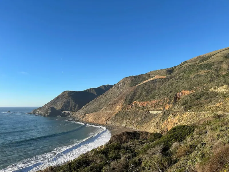
Highway 1 was reported fully reopened as of October 2026, but travelers should still check for controls and closures before driving. As of October 23, 2026, Caltrans reported one-way controlled traffic at Rocky Creek Bridge, south of Monterey, continuing through November 30, 2026.
That control can affect the pace of a Big Sur drive even when the highway is open. Check Caltrans Highway 1 conditions immediately before you set out, and again if your travel date is several days away. Road status can change after your itinerary is planned.
Big Sur can be a November stop when the road is passable, but avoid planning around an assumed uninterrupted drive. Keep flexibility for traffic controls, and confirm access to individual parks and trails. As of October 16, 2026, Pfeiffer Big Sur State Park had reopened many areas, including day-use areas, its campground and Redwood Grove Boardwalk, while several trails remained closed. Check the park’s current notice for updates.
If your plan includes driving north and south on Highway 1, review the route from both directions and confirm that the sections you need are open. The step-by-step travel emergency guide is useful to save before a long drive in case you need to revise plans on the road.
What is California weather like in November?
November weather depends on where you go and how high you travel, so use local forecasts rather than treating climate averages as predictions. Higher-elevation destinations can see snow and chain controls, while desert parks are generally milder by day and cooler at night.
Yosemite Valley’s November climate averages are a high of 56°F, a low of 33°F and 4.1 inches of precipitation, based on 1991–2020 averages. Check the Yosemite National Park weather information and the forecast close to your visit. Pack layers for cold mornings and wet weather in the valley.
At Furnace Creek in Death Valley, the November average high is 77°F and the average low is 48°F. The park is open daily year-round, and autumn begins in late October, with warm, pleasant temperatures and generally clear skies. See the Death Valley climate information before deciding what to pack or how much time to spend outdoors.
Joshua Tree’s fall temperatures are typically around 70–85°F for highs and around 50°F for lows. Conditions vary, and strong winds or flash flooding can occur. The park does not require a reservation to enter; check the Joshua Tree visitor FAQs and forecast before your visit.
Is Tioga Road open in Yosemite in November?
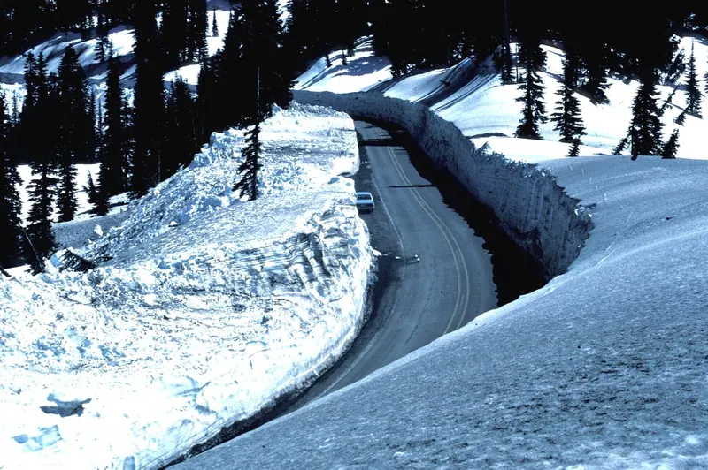
Tioga Road usually closes due to snow sometime in November, and it typically remains closed until late May or June. The actual closing date varies from year to year, so check the National Park Service Tioga Road updates before routing your trip.
When Tioga Road is closed, you cannot drive through Yosemite to Tuolumne Meadows or enter the park from the east via Tioga Pass. Yosemite Valley and Wawona remain accessible by car year-round, subject to road conditions, so a western approach is the sensible plan for a November visit.
Do not build a cross-Sierra itinerary that depends on Tioga Road being open. If you are traveling from the east side, check the route before setting out and be ready to use a different approach or change your plans. Check Yosemite’s road information for seasonal status updates on other roads you intend to use.
Do you need snow chains to drive to Yosemite in November?
You may need tire chains, depending on road conditions. Yosemite says chains are often required on roads inside and outside the park from November through March, but the requirement depends on conditions at the time.
Check controls before you drive and carry the equipment required for your vehicle and route. Caltrans advises travelers to use QuickMap and its winter driving guidance for current road conditions, chain controls and closures. California permits studded snow tires from November 1 through April 30.
Yosemite Valley and Wawona are accessible by car throughout the year, but access does not mean roads will be free of winter controls. Check conditions again on the day of travel. If the forecast or road report changes, postpone a mountain drive rather than pressing on to keep an itinerary intact.
What should you check before driving California mountain roads?
Check the road report, chain controls, forecast and park notices before each mountain-driving day. A route that appears open when you book lodging can have different conditions by the time you arrive.
- Check highway status: Review Caltrans reports and QuickMap for closures, delays and chain controls on your planned route.
- Confirm seasonal pass access: Check Yosemite’s Tioga Road page if your route crosses the Sierra or uses the east entrance.
- Check park access: Review park alerts for road, trail and facility closures, including at Big Sur.
- Look at the local forecast: Check the forecast close to departure for each elevation and destination, not just the nearest city.
- Keep a backup plan: Identify a route or stop you can substitute if a road closes or driving conditions deteriorate.
If you are driving in winter conditions for the first time, review the vehicle and packing checklist before you go. Travelers with questions about medical coverage can also read what Medicare may cover when traveling.
Which November route has the most reliable weather?
A desert-focused route is often the more straightforward choice for comfortable daytime temperatures, while a coastal route does not depend on crossing a high mountain pass. Neither option removes the need to check current conditions: Joshua Tree can have strong winds or flash flooding, and Highway 1 can have traffic controls or closures.
Choose the coast if Big Sur and coastal towns are central to your trip, and keep an eye on Caltrans updates. Choose Joshua Tree and Death Valley if you prefer desert landscapes and want to avoid relying on a high-elevation pass. Add Yosemite only with a western approach unless Tioga Road is confirmed open for your dates.
Death Valley’s private-vehicle entrance pass was $30 as of October 23, 2026. Check the park’s current fee information before travel, and plan for cooler nights as well as warm daytime conditions. Joshua Tree does not require an entry reservation, but visitors should still check park information and weather before driving in.
Frequently asked questions
How many days do you need for a California coast road trip?
The route from Los Angeles through Big Sur to the Bay Area has several worthwhile stops, so choose the number of days around how many places you want to visit. Leave flexibility for Highway 1 traffic controls and changing conditions.
Can you visit Joshua Tree and Death Valley on one November trip?
Yes. They are a reasonable pair for a desert-focused itinerary, and both have fall conditions that can suit daytime visits. Check each park’s current information and forecast before driving.
Can you drive through Yosemite in November?
Only if the route you need is open. Tioga Road usually closes due to snow sometime in November; when it is closed, use a western approach for Yosemite Valley or Wawona.
Are California roads closed in November?
Some roads, especially high-elevation routes, may close seasonally or temporarily because of snow or other conditions. Check Caltrans and the relevant park’s road updates shortly before travel.